CS #2: Sources, pathways, fate and transport of PFAS and PM(T)s in the Danube basin semi-closed water cycle
Our Aim: Providing improved knowledge to secure the safety of drinking water
The International Commission for Protection of the Danube River (ICPDR) has identified the pollution from hazardous substances as a significant issue in the Danube Basin. That is no wonder: The Basin receives discharges from wastewater treatment plants (WWTP) and stormwater from an area with more than 80 million inhabitants throughout 14 countries. About a quarter of them live in the five countries surveyed for this case study. At the beginning of the project, there was a lack of knowledge about PFAS in the river and how these chemicals impact the drinking water abstracted via bank filtration along the river.
Case Study 2 focused on a large-scale river catchment that runs from the mouth of the Danube Basin to Budapest, Hungary, including the bank filtration areas. Our aim was to develop methods:
- for quantification of the origin of selected chemicals discharged to the Danube River
- to assess the behavior of these chemicals during filtration in the riverbanks and during drinking water abstraction
- to identify effective measures to control pollution levels in rivers and in drinking water impacted by rivers
The innovative combination of modelling approaches will enable the assessment of risks to human health and the environment at different temporal and spatial scales (short and long-term trends, source to catchment scale) in soil, sediment and water, which can be applied in other river basins worldwide.
Conclusion
Monitoring PFAS & PMT(s) Occurrences and Concentrations
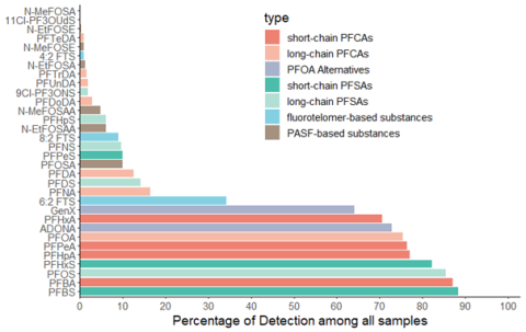
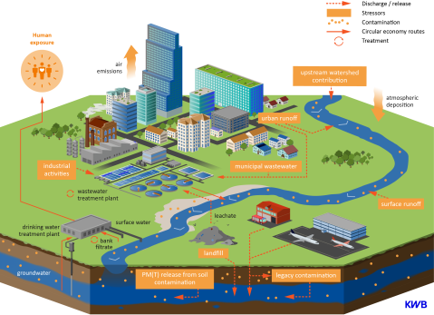
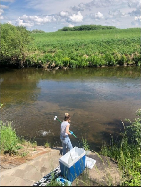
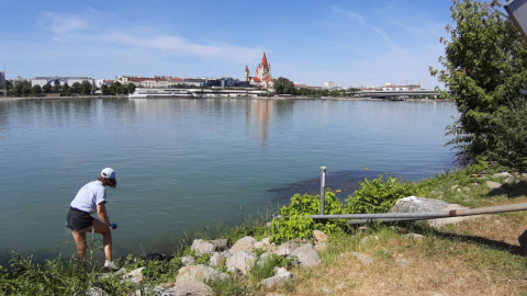
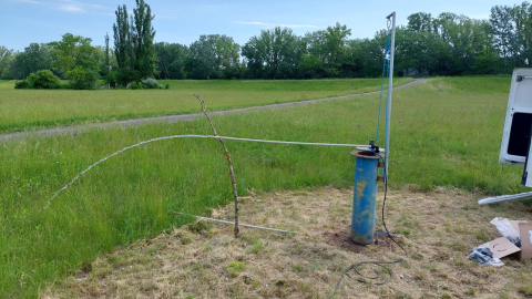
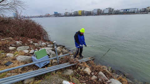
A comprehensive monitoring campaign was conducted across the upper Danube Basin, covering various environmental compartments including atmospheric deposition, surface runoff, landfill leachate, wastewater and surface water. Particular efforts were devoted to sampling the Danube and bank-filtration sites from four transects with different characteristics (1 site in Vienna, 3 sites in Budapest) along the Danube. A harmonised database was developed to store the targeted analysis results for 32 PFAS compounds. Additionally, non-targeted analysis approach was applied to broaden the scope, identifying a wider range of PMT(s).
Modelling PFAS Transport and Emissions
Based on monitoring results, ten PFAS compounds of highest concern were selected for detailed investigation using different modelling techniques. The concentrations database served as critical input sources and validation set for the models.
At large catchment scale, a pathway-oriented regionalised emission model (MoRE) and a source-oriented watershed model for PM substances (PPM) were developed, focusing on quantifying PFAS emissions via different approaches. Hydrological parameters such as precipitation, evapotranspiration and overland runoff were abstracted from the Wflow model component of the PPM, which was optimised specifically for the case of upper Danube, providing the foundational input for further simulations. These models covered a temporal scale from 2015 to 2021 annual and daily, respectively.
At bank-filtration sites, the modelling approach utilised 3D numerical methods, integrating MODFLOW-2005 and MT3DMS within the iMOD-WQ framework to simulate PFAS transport during riverbank filtration (RBF). In Vienna, a small-scale model with well-defined boundaries captured groundwater flow accurately, aided by sandy soils, a clogging layer, and no pumping, which simplified flow dynamics. Conversely, in Budapest, regional groundwater models with localized cut-outs were employed to address complex hydrological systems influenced by varied sources and extensive groundwater mixing.
Scenario Modelling and Risk Assessment
The two catchment models and the RBF model were used to evaluate the risk of summed PFAS concentrations exceeding limits set by the Drinking Water Directive (DWD) and proposed Environmental Quality Standards (EQS) at two riverbank filtration sites. Hypothetical scenarios, developed as small stories, demonstrated how potential developments and events could influence model predictions and address future uncertainties.
These scenarios examined various factors, including pre- and post-climate change conditions, PFAS production cessation, accidental PFAS spills, and water pollution control measures. Key findings indicate that while climate change exacerbates PFAS risks due to reduced dilution during low-flow periods, measures like remediation of PFAS-hotspot regions (from former firefighting foam-applications and municipal landfills) advanced wastewater treatment and PFAS use-restrictions can mitigate these effects. Scenarios also reveal contrasting outcomes depending on spill conditions and hydrological settings, with old firefighting foams (PFOS-based) posing significantly higher risks than newer formulations (6:2 FTS-based).
These results emphasize the need for robust water management and site-specific hydrogeological assessments to mitigate risks, particularly under worsening climate scenarios. Moreover, long-term contamination persists in groundwater, with recovery potentially taking years, showing the importance of proactive measures, including pollution control and a thorough understanding of site-specific conditions, to safeguard drinking water quality.
Our Publications
-
The occurrence and persistence of PFAS at riverbank filtration sites in the Upper Danube basin (29 July 2023)
-
Regionalised Emission Model (MoRE) for PFAS from H2020 Project PROMISCES - Case Study 2
Photo Gallery
.png)
Steady-state calibration of high-resolution Bank Filtration model in Budapest, for a 10th percentile Danube low-flow that lasted for one week in October, 2022. Red lines represent boundary conditions gained from the tiered large-scale model developed by Deltares, while white boxes show calibration errors in m. @TU Wien

.jpg)
.png)
.png)
